Uninhabited islands
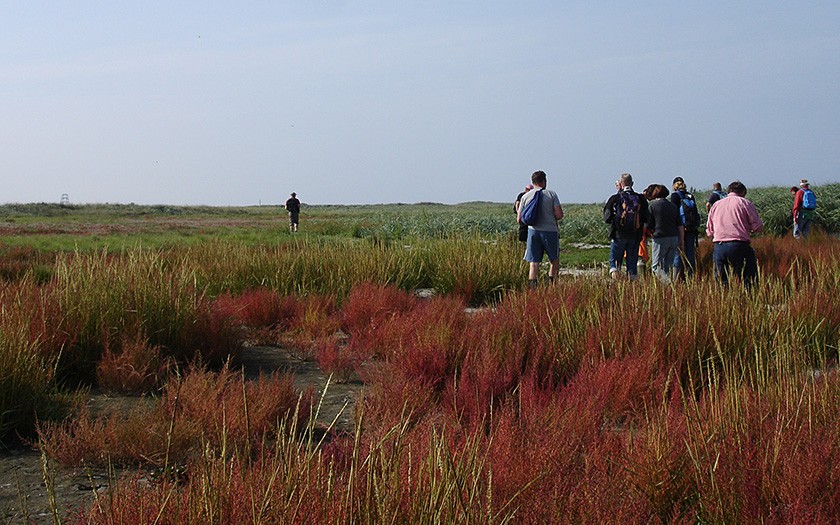
In the Wadden Sea, there are many bare sandbanks and mud flats, but also uninhabited islands. That is to say, sandbanks which are so elevated that the highest part remains dry throughout the year. They are permanently overgrown with plants. From west to east, the Dutch islands are Griend, Rottumerplaat and Rottumeroog.
The uninhabited island Griend
The bird island Griend lies within the boundaries of the town of Terschelling, halfway between the island and Harlingen. It used to be much larger, inhabited and famous for its cheese. Nowadays, it is known for its rich bird life. In addition, it is one of the most important high-tide refuges in the wadden region. For these reasons, the island falls under the Nature Protection Act. Without protective measures from man, the island would probably have already disappeared in the waves.
Griend: a short history
In the early Middle Ages, extensive salt marshes lay south of Terschelling, Ameland and Schiermonnikoog. On the highest section of such a marsh was Griend, a village or small city. The salt marshes and the village of Griend more or less washed away during the St. Lucia flood on 14 December 1287. The area turned into a kind of ‘hallig’: an island built from remnants of salt marshes (halligs are still found in the German Wadden Sea). Erosion from the waves created cliff coasts, with sharp borders along the higher areas of the marsh. Erosion continued and Griend slowly but surely disappeared into the sea. The surface area of Griend at the end of the 14th century was only 165 hectare; in the 19th century, 25 hectares.
Under influence of water and wind, the overgrown sickle-shaped island of Griend slowly moved in an easterly direction. According to calculations, the island lay several kilometers to the west in the 13th century. In 1913, the Texel Family Lap had rights to Griend, allowing them to mow and gather eggs. In the same year, the Texel nature conservationist Drijver proposed to purchase Griend and make it into a nature area. That succeeded in 1917, when Griend became a bird reserve, managed by Natuurmonumenten.
Colony birds on the uninhabited island Griend
Various species of terns and one species of gulls nests on Griend: the black-headed gull. Sandwich terns, Arctic terns and common terns nest in large numbers. Sometimes small amounts of little terns will also be found. The Netherlands is the most southerly border for breeding Arctic terns and it is considered a fairly rare nesting bird in the region. Griend accommodates around one third of the Dutch population. The pairs breed on the edge of the beach in the bare sand. In a good year, it can mean more than 1000 pairs of common terns and thousands of sandwich terns. They make their nests near the beach ridge in reasonbly thick vegetation. And between all of these nests are the nests of thousands of pairs of black-headed gulls. They fill up all of the last open spaces. Nesting on Griend has its advantages. There are no predators such as foxes; in addition, no plundering birds such as herring gulls nest here. In addition, Griend lies extremely advantageous with respect to rich fishing grounds, where the terns can hunt food for themselves as well as for their young.
Accessibility to this uninhabited island
Griend is not accessible for the public. In fact, it is forbidden to trespass. The Foundation for the Preservation of Nature Monuments (Natuurmonumenten) leases the island and has designated it for birds. It is one of the very few places in the Netherlands exclusively designated for nature and, with the exception of scientific studies, no other joint use. Every once in awhile, Natuurmonumenten organizes a day to remove the marine litter washed ashore on the island, such as nets, plastic, lamps, crates and bottles.
Formation of the uninhabited island Rottumerplaat
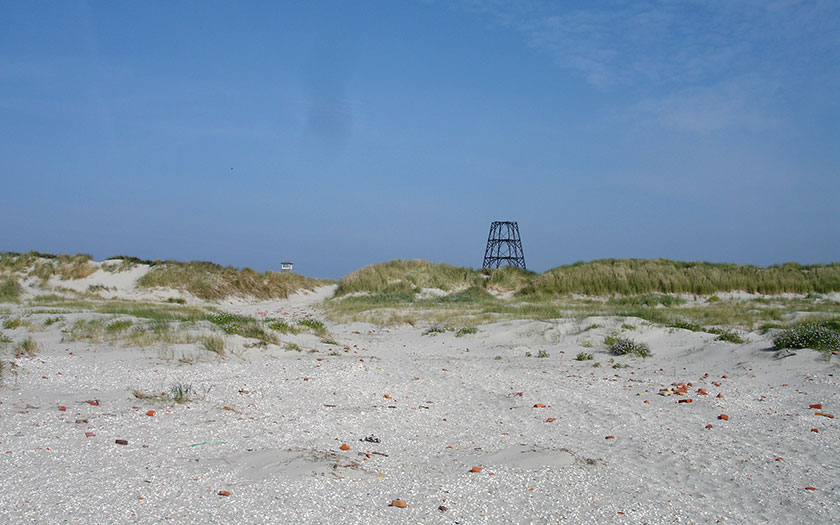
In 1833, a sandbank formed west of Rottumeroog. By 1860, it was so large and elevated that dunes started to form. The new island was named Rottumerplaat. After 1950, a wind-blown dike was constructed by Rijkswaterstaat. In those days, there were plans to turn Rottumerplaat into a work island for reclaiming the Wadden Sea. In 2000, Rottumerplaat had a surface area of approximately 1000 hectares.
Rottumeroog, another uninhabited island
In the 16th century, Rottumeroog lay where Rottumerplaat now lies. It was called Rottum and the island was 9 to 10 kilometers long. Up till 1965, a warden lived there with his family, the Toxopeus Family. The surface area of Rottumeroog is now only 250 hectare. The island has a history of continual erosion, protective measures and unexpected development. One assumed that if nothing was done, the island would disappear into the Westereems. Volunteers have stretched this process out as long as possible. However in 2002, all measures for protecting the coast were ended.
Uninhabited island left alone
Fifteen years later, Rottumeroog still hasn’t disappeared into the sea. It changes shape, it wanders, but it stays approximately the same size. A large protective sandbank surrounding the island has definite influence. The old wind-blown dike has broken through at 1/3 of the beach ridge. Vegetation with pioneer plants grow in this opening, although it fills up with fresh sand during storms.
Nature on Rottumerplaat and Rottumeroog
Rottumerplaat is an important area to rest and forage for bird species found on beach plains: sanderlings, dunlins and Kentish plovers. A large number of coastal birds also nest on Rottumerplaat and Rottumeroog: eiders, shelducks, Arctic terns, common terns, little terns and ringed plovers. The sandwich tern started breeding here in 1996, expanding into a colony of 2335 nests by 1998. The sandwich tern was a fairly rare bird for the Netherlands.
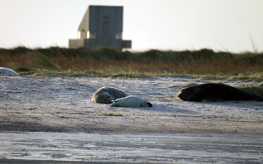
Both islands and the mud flats to the south are nature reserves. Rottumerplaat is closed to the public the entire year. There is a warden from 25 April to 18 August. There are two buildings on Rottumerplaat: the ‘drenkelingenhuis’ (house for people that almost drown) and a building belonging to the State Forestry. This is housing for the wardens, and for volunteers that are given special permission to stay on the island to take nature inventories.
Uninhabited island as reference area
Since 2005, Rottumerplaat, Rottumeroog and the tidal flats to the south form a reference area for the Wadden Sea, where fisheries have been banned. Natural development is studied yearly. Every five years, biologists evaluate how the area is developing compared to the rest of the Wadden Sea.
Gas in the vicinity of the uninhabited islands
The Dutch natural gas exploiter NAM is not allowed to perform any activities south of Rottumeroog and Rottumerplaat. Any exploitation of gas supplies in the vicinity of the islands will have to take place from the North Sea.
Discover the magic of the Wadden Sea
Discover Wadden Sea World Heritage in this interactive exhibition.
Read more


