The Mok Bay and vicinity
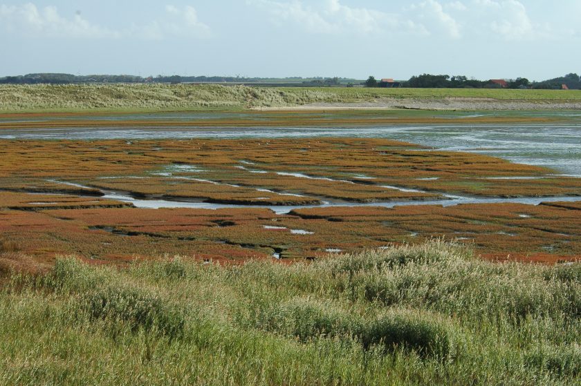
The Mok Bay is an inlet in the southern coast of Texel. You see it in the west when you arrive with the ferry. A large part of the bay is exposed during low tide. Salt marshes have formed along the edges. Two bird reserves lie to the north: the Petten and ‘t Stoar. The dike is a great spot for bird-watching. Biologists from the NIOZ and Wageningen Marine Research (formally IMARES) use the Mok Bay regularly for various studies. Mariners train in the bay with rubber boats and landing gear. When the Mok Bay was dredged in 2005, more than 5300 explosives were removed.
The Spanish Channel (Spanjaardgat) and the Mok Bay
Around 1700, the coastline was located where you now find the Siborsnollen and Loodsmansduin dunes to the south of Den Hoorn. The Spanish Channel lay southwest of these dunes. For centuries, this was an important navigational route. The channel grew consistently shallower after 1700, and in 1749 the sandbank the Hors – lying on the other side of the Spanish Channel, attached to the island. The southeastern part of the Spanish Channel was still open and is presently the Mok Bay.
The Mok Bay became a safe harbor for overwintering merchant vessels. However, wind-blown sand threatened to fill the bay. In 1846, a long wind-blown dike was constructed at the northern end of the bay in order to keep it open. Nowadays, the channel entering the Mok Bay is kept open by dredging, which is necessary for the military training camp.
‘Airfield’ in the Mok Bay
From 1917 till the beginning of the Second World War, the Mok Bay was used as a landing for waterplanes. The Dutch Navy Aviation Service stationed their watercraft here. A large basin was dredged in the Mok Bay to allow the planes to land at all times, including during low tide. On May 10 and 11 1940, the Mok Bay was bombarded by the Germans, destroying many of the airplanes. The Germans turned the Mok Bay into an area for stationing anti-aircraft artillery, intended for protecting Den Helder from bombing attacks. After the Second World War ended, the airfield was never repaired.
Fish ladder for sticklebacks by the Mok Bay
A fish ladder was built in 1997 to restore fish migration between the Mok Bay and the Mok ditch, esecially for the sticklebacks, . This ladder makes it possible for the fish to migrate from the Wadden Sea to the lakes in the dunes. It consists of five sections, each having 4 or 5 steps. The steps are 5 centimeters high; the total difference in height is 110 centimeters. Water from the Mok Ditch flows via these steps to the Mok Bay. Sticklebacks have no problem jumping the 5-centimeter elevations. More sticklebacks are now in the lakes, so that the spoonbills benefit.
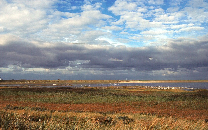
Salt marsh in the Mok Bay
There are two salt marshes in the Mok Bay. As the name indicates, the salt marsh ‘the puntje’ lies at the opening of the Mok Bay, where the seawater from the Marsdiep channel enters. Salt marsh the Karhoek (‘cart corner’) lies at the inner edge, bordering the dunes. The name comes from the days when sea merchants spent the winter in the Mok Bay and carts with water were brought to the ships via this marsh.
De Petten en ‘t Stoar adjacent to the Mok Bay
The Petten and ‘t Stoar are two bird reserves owned by Natuurmonumenten, located behind the dike bordering the polder Hoornder Nieuwland. The Petten is a brackish lake with a number of little islands. The islands are protected from erosion by low piling. A layer of shells lie on top, making them suitable brooding areas for avocets, black-headed gulls, ringed plovers and common terns. Bird watchers get a great view of the area from the road. The birds fly back and forth over the dike. They catch fish for their chicks in the Mok Bay. During extreme high tides, large numbers of shorebirds use the area as a high-tide refuge. ‘t Stoar is the meadow bird reserve to the east of the Petten. Avocets, black-tailed godwits and lapwings nest here. Wigeons are often found here in the winter.
Discover the magic of the Wadden Sea
Discover Wadden Sea World Heritage in this interactive exhibition.
Read more


